There’s a great new way to learn to use Google’s APIs, including maps, with the Ajax Playground. See, edit and run the code from nearly 50 mapping examples.
The interface is great for trying stuff out. You won’t need to swap windows or dig through unrelated code to figure out what’s important. If you’re logged in to a Google account, you can even save your changes or export your code for use in a real project.
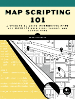
Today I celebrated a milestone by completing a draft of the first chapter of my book about online mapping. Now it’s off to my editor, who I expect to have a double helping of constructive feedback.
Incidentally, it was chapter two that I finished first, skipping chapter one. Teacher always said to write your introduction after you’ve written the conclusion.
Chapter two covers the mapping APIs discussed in the book and makes a case for Mapstraction, which I plan to use wherever possible. I also give some basic examples, like adding controls to the map and setting the zoom level.
I’m still just getting started in the global perspective of the book, but it feels good to pass a big ol’ psychological checkpoint.

The cover of the most recent Wired was devoted to what it calls the “GPS Revolution.” Of course, the trend of location-based services goes beyond global positioning systems. Much of the coverage was devoted to discussion of mobile computing’s role.
Mathew Honan wrote a great piece about being a location-aware guinea pig:
Millions of people are now walking around with a gizmo in their pocket that not only knows where they are but also plugs into the Internet to share that info, merge it with online databases, and find out what—and who—is in the immediate vicinity. That old saw about how someday you’ll walk past a Starbucks and your phone will receive a digital coupon for half off on a Frappuccino? Yeah, that can happen now.
We’ll be seeing a lot more articles like this soon, moving to more mainstream press. Sharing location enables a whole bunch of cool tools that we don’t even know about. Still, people will be appropriately skeptical. To many it will feel like a giant invasion of privacy, even if they grant permission.

Google Maps is the mashup mainstay, but it’s not the only game in town. You may prefer the deep red color of Yahoo Maps freeways or the bird’s eye view in Microsoft Live Earth.
My advice to those new to mapping is always the same: go with Mapstraction. It’s not an API itself, but a wrapper for about a dozen other mapping services. You can write once with Mapstraction and switch providers later on.
Say you choose Google Maps now (and most of us do). Down the line if Google chooses to put ads on the map, for example, you’d be able to switch to Yahoo with minimal changes to the underlying code.
There are some downsides to using Mapstraction. It is built to work with many providers, meaning that Mapstractions features can only be those shared by all mapping platforms. When Google releases a hip new feature, that might not be immediately available in Mapstraction. Nevertheless, for most common mapping projects, this won’t be an issue.
Get started with Mapstraction by reading my Mapstraction tutorial at Webmonkey.


 Hi, I'm Adam. I'm writing a book about developing maps on the web. This site is where I'll share the things I find and help you create your own maps.